The Zumbro River
Driftless Place Names

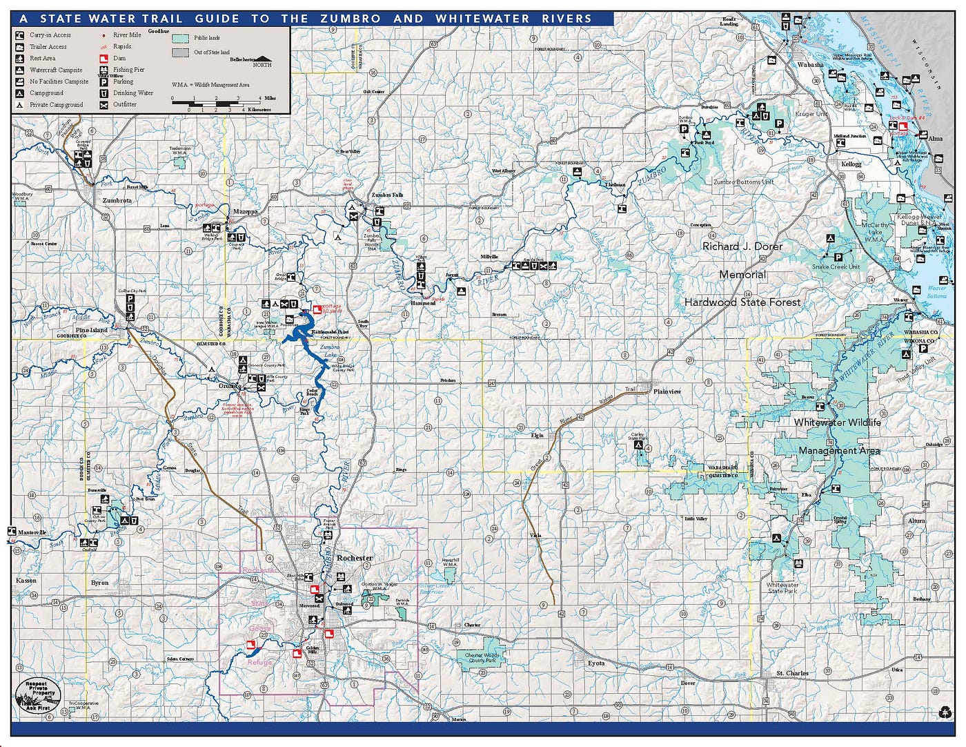
The Zumbro River — River of Obstructions, Place Where the Pines Grow. This 1,422 square-mile watershed hosts a dendritic network of forks and branches draining undulating uplands through marshy bottoms to a channeled confluence with the Mississippi River. Its name, and the names of places situated along its various reaches, are combinations of Indigenous Dakota descriptions, French titles dating from the fur-trade era, and settler names applied mostly around the time of Minnesota’s statehood in 1858.
Why place names? Names signify collective relations, memories, and aspirations. “All languages are composed of roots, and those roots are loaded with meaning,” writes Anton Treuer, Professor of Ojibwe at Bemidji State. “In English, most roots come from the language’s Latin, Greek, Celtic, and Germanic underpinnings.” Word origins, or etymologies, are “usually unknown to everyday speakers of English,” Treuer writes in Everything You Wanted to Know about Indians but Were Afraid to Ask. However, among people familiar with a region’s Indigenous languages, Treuer says, “the roots of words and their deeper meanings are often known.”
This rootedness of language can help current residents of Minnesota — settler, Indigenous, and immigrant — better understand the places we collectively call home. A place is more than its geographic location; places are pluralistic — locations imbued with meanings, social connections, and inextricable ecological underpinnings. Place meanings are often overlapping, usually positive, yet sometimes negative or conflicting; they tend to guide us in our evolving relationships to the lands and waters which give birth to life and hold us in eternal rest.
Place names, particularly those with Indigenous language roots, honor deep-time relationships to people, yes, but also relational connections to rivers, forests, prairies, and hills. Indigenous names have often been misspelled and misconstrued by settlers but remain in various iterations. As Treuer suggests, European naming and mapping conventions tend toward places named after local settlers (e.g., Hammond, Mantorville, Theilman), people from elsewhere (e.g., Mazeppa, for Ivan Mazepa a 17th century Ukrainian Cossack hetman; Kellogg, for “a Milwaukee gentleman who furnished the depot signs,” see Upham) or other places (e.g., Dumfries, Rochester, West Albany). Sometimes geographic features inspired names, such as Zumbro Falls, Millville, or Pine Island. Examining the roots of place names — finding deeper meanings — can help foster connections between the land and its cohabitating living systems, including humans. Among the river bottoms, terraces, forests, and uplands lies an opportunity learn more about our own backyards, these living watersheds, and to reconnect during times of great separation.
As Gwen Westerman & Bruce White describe in their book of the same name, Minnesota’s name is derived from the Dakota phrase Mni Sota Makoce, meaning Land Where the Waters Reflect the Clouds. Minnesota has been a place of diverse and distinct Indigenous cultures for over 12,000 years. Across the millennia, languages and lifeways of Ojibwe (formerly Chippewa), Ioway, Oto, Sac & Fox, and Ho-Chunk (formerly Winnebago) peoples have called different parts of Minnesota home. Yet southeastern Minnesota is most deeply a place of the Dakota — in particular, the Mdewakanton and Wahpekute bands of Eastern Dakota whose legacy remains rooted in place names such as Red Wing, Wacouta, Wabasha, Watopa, Witoka, Winona and others, as well as in communities where historic cultures thrive into the resilient present and ever-emergent future — the Shakopee and Prairie Island Dakota communities.
The project of settler-colonialism has at its core the attempted erasure of North America’s original peoples. After generations of systemic disenfranchisement, and specifically after the Dakota Uprising of 1862, Dakota people were exiled from Minnesota. The riverine Driftless Area of southeastern Minnesota became a nearly-exclusive locale for Norse-German settlers lured by the myth of Manifest Destiny. A focus on names-in-place established prior to settler incursion is a reasonable starting point for reconnecting what settler-colonialism has worked so diligently to disconnect — people and the land. Disconnected land use, land as commodity rather than community, shows itself in the legacy of intensive, chemically induced monocultures; tainted groundwater; and highly erodible river banks. Short-term economic gains dominate while other values become subordinate. In contrast, connected lives-in-place consider longer views of time, intergenerational responsibility to soil health (thus the health of all plants and animals growing from it), and relational and intrinsic values inherent in the pluralism of our collective senses of selves-in-place. Driftless Minnesota and its unique karst geology flows with mystery and deep-time history. Its names help us, in part, understand places of the past, the challenges of conflict over time, and resilience in the face of dynamic and emergent change.

The greater Zumbro river system encompasses 900,000+ acres and is one of the four primary watersheds in southeastern Minnesota. The Cannon River (Inyan Bosdatu in Dakota, “standing rock”), to the north of the Zumbro, is an interesting place name itself, derived from a misspelling of canots (canoes in French). Downstream from where the Zumbro meets the Mississippi, the Whitewater River opens at Minnieska. The Whitewater valley is imbosomed by the South Branch of the Zumbro (to the north) and the outstretched North Branch of the Root River (to the south).
It is upon these uplands in the 1830s that Joseph “Jack” Frazer or Ite Maza (Iron Face) wintered with his uncle, Wakute or Wacouta, on the headwaters between the Root and Whitewater. Recorded through the pen of Henry H. Sibley and elaborated upon by historians Gwen Westerman (Sisseton Wahpeton Oyate) and Bruce White in Mni Sota Makoce, Frazer journeyed to the upper reaches of the Zumbro, near present-day Pine Island, with his father-in-law Maza Hota, chief of Black Dog village. They hunted and camped around the Zumbro’s middle branches for a few weeks before Frazer and his wife returned the to Root River. The place of the pines “had been a wintering place for Dakota from Wakute’s band for generations,” write Westerman and White; this was also the location Wakute requested for his people to live during the 1851 Mendota treaty negotiations. That request, like so many others, went unheeded.
Pine Island, rather than land surrounded by water, is described in W.H. Mitchell’s Geographical and Statistical Sketch of Goodhue County as an island of pine amid a sea of prairie. This arboreal phenomenon was located near the confluence of the Zumbro’s Middle Branch with its North Fork. Near the present namesake city, Mitchell writes:
…there was quite a forest of pine, which could be seen for a long distance over the prairie, giving it quite the appearance of an Island in the sea, from this circumstance it derived its name of Pine Island. It was one of the curious freaks of nature that planted a small forest of pine trees here on this narrow point of land between the two branches of the river, while there is none anywhere else within perhaps a hundred miles of the place.
As a settler community, the town emerged in the mid-1850s “when a number of home seekers selected this spot as a field for future operations,” writes Mitchell. Those “operations,” included cutting down most of the large white pines. By the time Mitchell was writing, in 1869, “some 200,000 feet of lumber was manufactured from the little Island of pines.”
The Middle Fork of the Zumbro drains 277,816 acres (31%) and is the largest of the five lobes or watershed drainage areas identified by the Zumbro Watershed Partnership. The North Fork flows through Kenyon, Wanamingo, Zumbrota and Mazeppa; it is the smallest lobe, draining 153,149 acres (17%) of the watershed. The South Fork flows east before meeting the many impermeable surfaces and stormwater impoundments of metro Rochester. The South Fork drains 232,574 acres (26%) of the watershed, flowing north and into the central lobe, or Lake Zumbro area. Lake Zumbro was created in 1919 by a hydroelectric dam built by the City of Rochester. Entering fully into the geologically unique Driftless Area, the Lower Zumbro begins around the confluence of the three Forks and flows through a circuitous channel between Zumbro Falls and the flats beyond Kellogg.

The Lower Zumbro basin, covering 211,903 acres (23%) of the total watershed, looks much different than it did pre-settlement but some consistent features include the rugged bluffs and their layered limestone, dolomite, and sandstone outcroppings, forested hardwood hillsides and, in the bottoms, scatterings of driftwood snags — trees and branches submerged in the river itself. Because of these encumbrances to upriver navigation in the fur-trade era, where a regional French was the patois of the trade, the river was called the Rivière des Embarras — pronounced days-ombarrAH — meaning river of difficulties or obstructions.
In an 1883 History of Olmsted County, Lafayette Bunnell wrote that the Zumbro received its name from early Jesuit missionaries. “It was named by them in French, Les Ambras, signifying the embarrass, or river of obstructions,” wrote Bunnell, “which name it was called by the Indians, and by the white men who first settled here the name was anglicized to Zumbro.” Similarly, in a later History of Olmsted County, Joseph Leonard wrote in 1910 that the French name of the river “became abbreviated and corrupted by the careless and slurring pronunciation of the voyageurs and trappers into Zumbro, by which it has since been called.” Leonard drew from a 1899 report by Thomas Simpson who in 1853, at 17 years old, was tasked with marking the guide meridians and standard parallels that would eventually lead to the quarter-by-quarter dissection of countryside all across Minnesota. Bunnell, Simpson, and Leonard all perpetuate an error in interpretation about the Zumbro name, however. Simpson, similar to Bunnell, asserted that the river known as Zumbro “was given on our maps, made by Nicollet and Fremont, as the Embarris, a French translation of the Indian name Waziouji.”
As Westerman and White make clear in Mni Sota Makoce, early European trade and exploration by the likes of Pierre Le Sueur sometimes used different names for the Zumbro (e.g. Rivière aux Raisins or “River of Grapes”) but Le Sueur, in 1700, also applied the correct Dakota name and interpretation, calling it “Outaba Ouasiaujou” or Wazi Ożu Wakpa, meaning “River Where the Pines Grow.” Joseph N. Nicollet, on his topographical military mission of 1836, also applied “Wazi Oju R.” in his extensive notes and records, creating an important record “of Dakota geography and place names in the nineteenth century,” according to Westerman and White.
Wazi Ożu is what place name historian William Bright would classify as a Traditional Native American Placename — a term used by Indigenous peoples in their own language. Wasioja township and village in Dodge County offer a derivation of this original name. Other place names in the watershed are combinations of Indigenous, French, and English, or altogether made-up. As Warren Upham notes in Minnesota Place Names, “Rivière des Embarras, was unrecognizably transformed into Zumbro, which is used on the map of Minnesota in 1860.” The village and township name of Zumbrota, writes Upham, “adds a syllable, the Dakota suffix ta, meaning ‘at, to, or on,’ that is, the town on the Zumbro, being thus a compound from the French and Dakota languages.” Conversely, the village site of Tepeeota near the mouth of the Zumbro is what Bright would classify as a Dubious Native American Term — “imaginative, even fraudulent, attempts to imitate Indian models.” The History of Wabasha County, published in 1884, provides details of such imagination:
This quarter section was situated upon the Mississippi, four miles below Wabashaw [sic]. The location was indeed beautiful, it being an island in the delta of the Zumbro. The bluffs of the Mississippi are about four miles back of this point, and the surrounding county was level. This island for many years had been the general encampment of Wapashaw’s band, and the proprietors of the village determined to name their city Tepeeotah, from the Indian tongue “teepee,” meaning house, and ‘otah,’ many.
The proprietors of the Tepeeota village site included an ex-governor of Ohio, and a judge from Pennsylvania who, together, purchased the land and laid out the village site in 1856. Upham also notes that the village met a fiery end “on a March night in 1859” when “its deserted steam sawmill, three-story hotel, and stores, mostly then empty, were burned by incendiarism.”
Like many settler village sites and wayfaring routes in the Upper Midwest, the selected location of Tepeeota had been used before and during the fur-trade era. The expansive site was long referred to as the Grand Encampment — a location below and across from the mouth of the present-day Chippewa River. The Chippewa River’s outwash plain, over time, created present-day Lake Pepin as a blocked flowage of the Mississippi. Offering a location of strategic advantage, the Grand Encampment was for generations the perfect place to rest, gather, reconnoiter, and hunt on the nearby river bottoms and uplands. On July 13, 1817, Major Stephen Long and a reconnaissance team traveling upriver on a six-oared skiff noted the location as such:
Passed the River au Boeuf coming in from the north. It is of moderate size and is navigable in high water about thirty miles. Buffaloes are found on this river which gives occasion to its name; the Indians hunt them here in all seasons; they are not however very numerous. Opposite to the mouth of this river, on the west side of the Mississippi, is a large prairie, situated between the bluffs and the river, being about two miles in width; on a part of it is a scattering growth of timber. Should there be occasion to send troops into this quarter, they might be posted to advantage at this place, as the position would be secure, and at the same time, afford a tolerable command of the river. The elevation of the prairie above the river is about twenty-five feet. Upon the upper end of the prairie is the Grand Encampment, or place of general resort for the Indian traders, during the winter, for the purpose of trafficking with the Indians.
For generations, mapping expeditions by the likes of Le Seuer, Long, and J.N. Nicollet have resulted in maps representing “an inherited legacy of intellectual colonialism” where military and other government maps have guided “the colonization and dispossession of Indigenous Peoples’ land, territories, and resources,” writes Dr. Kelsey Leonard (Shinnecock Nation) in an article titled Putting Indigenous Place-Names and Languages Back on Maps. With Global Information Systems (GIS) mapping capabilities, where layers can be added for depth and nuance of geographic, ecological, cultural, and infrastructure systems, GIS structures can — and should — writes Leonard, “be designed in ways that support Indigenous sovereignty and visibility — for the benefit of all.”
What would more inclusive mapping look like for Minnesota watersheds and ecoregions? One relevant example is Iyoka Eli- Wihtamakw Kǝtahkinawal / This Is How We Name Our Lands; a collaborative work by cartographer Dr. Margaret Wickens Pearce (Citizen Band Potawatomi) and members of the Penobscot Nation Cultural & Historic Preservation office in central Maine. This watershed-scale place-naming project draws from past to present, and present to past, for a more inclusive future along Maine’s Penobscot River “to expand the map” of traditional place name recognition and acknowledgement.
Symbolic and pragmatic, Indigenous-led mapping projects in Minnesota can also offer ballast to the overly-common settler-centric narratives of Minnesota’s collective memories-in-place.
For Further Reading:
History of Wabasha County. 1884. Chicago: H.H. Hill & Company. https://archive.org/details/historyofwabasha00hill/page/618/mode/2up?q=zumbro
Leonard, Joseph 1910. History of Olmsted County, Minnesota. Chicago: Goodspeed Historical Association. https://archive.org/details/mn-olmsted-1910-leonard
Leonard, Kelsey. 2021. Putting Indigenous Place-Names and Languages back on Maps. https://www.esri.com/about/newsroom/arcnews/putting-indigenous-place-names-and-languages-back-on-maps/
Treuer, Anton. 2012. Everything You Wanted to Know about Indians but were Afraid to Ask. St. Paul, MN: Minnesota Historical Society Press.
Upham, Warren. 1910/2001. Minnesota Place Names: A Geographical Encyclopedia. St. Paul, MN: Minnesota Historical Society Press.
Westerman, Gwen & White, Bruce. 2012. Mni Sota Makoce: The Land of the Dakota. St. Paul, MN: Minnesota Historical Society Press.
Essay originally published on April 19, 2021, as part of We Are Water MN, a collaboration between the Minnesota Humanities Center, Minnesota Pollution Control Agency, Minnesota Historical Society, and Minnesota Departments of Agriculture, Health, and Natural Resources: https://www.wearewaterrochestermn.com/thezumbroriveressay